Study on Bundelkhand of Planning Commission: Introduction - People and Administration
Study on Bundelkhand of Planning Commission: Introduction - People and Administration
People and administration.
The state has the population of 66.18 million in 1991 and land size of 443446 sq.kms. Thus the state has 8% of the country’s population and 14% of the country’s land area. MP is the largest state of India in terms of its area and sixth in terms of population. The literacy average is 44.20% with female literacy being as low as 28.85%. The decadal population growth rate of the state is 26.8% which is almost 2.9% higher than the national average.
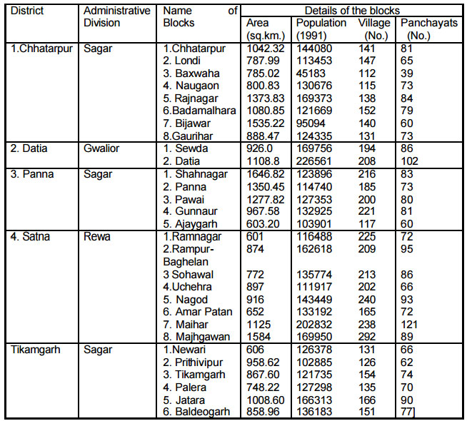
Bhopal, almost in the middle of the Central and Western parts of the state, is the capital of MP.The districts, under study, namely Datia, Chhatarpur, Tikamgarh, Panna and Satna have their headquarters of the same name. The state is divided into 12 administrative divisions 45 districts, 317 tehsils and 459 development blocks. The 12 administrative divisions of the state are - Chambal, Gwalior, Sagar, Rewa, Ujjain, Indore, Bhopal, Hoshangabad, Jabalpur, Bilaspur, Raipur and Bastar. While district Datia forms the part of Gwalior division, districts Tikamgarh, Chhatarpur and Panna are the parts of Sagar division. District Satna is the part of Rewa division.
Administrative Details