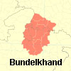
(Info) Boundaries of Bundelkhand

Bundelkhand
Geo Profile
Boundaries of Bundelkhand
As understood by the state governments of Uttar Pradesh (UP) and Madhya Pradesh (MP), 'Bundelkhand' comprises seven districts of southern UP and six districts of northern MP MP (see `Location of Bundelkhand’ and `Districts of Bundelkhand’ maps in Bundelkhand in Maps):
Jhansi, Lalitpur, Jalaun, Hamirpur, Mahoba, Banda, Chitrakoot districts (all in UP), and
Datia, Tikamgarh, Chhatarpur, Panna, Sagar and Damoh districts (all in MP).
The above delineation is different from boundaries suggested by proponents of a 'greater' or 'cultural' Bundelkhand, who include many more districts of MP.
However, the definition used by the UP and MP governments is the most useful from a practical viewpoint. This definition is also generally used by the media and civil society organisations when they refer to Bundelkhand.
(The listing of UP Bundelkhand districts is derived from the scope of the 'Bundelkhand Vikas Nidhi' set up by the UP government In 1990-91. The listing of MP Bundelkhand districts is derived from the scope of the MP Bundelkhand Development Authority created in April 2007).
The Boundaries of the Bundelkhand Region so Defined are:
- in the north, the Yamuna and the Ganga plain
- in the east, the Vindhyan hills and Panna-Ajaigarh ranges
- in the west, the Sindh and Chambal rivers, and the Malwa and Udaipur-Gwalior regions
- in the south, the Narmada and tributaries of the Ken and Betwa
- in the south and east, the Vindyachal and Bagelkhand regions
The Bundelkhand region within these boundaries has an area of around 70,000 sq km with a population of 15.5 million (Census 2001).
By way of rough comparison, Bundelkhand is one and one-third the size of Punjab, but with less than two-thirds the population of that state.
Courtesy : bundelkhandinfo.org
- Anonymous's blog
- Log in to post comments